
3D paving modeling provides detailed three-dimensional visualizations for both existing and planned pavement projects. By integrating this technology during the planning phase, contractors can decrease costs and enhance productivity, effectively shortening project timelines.
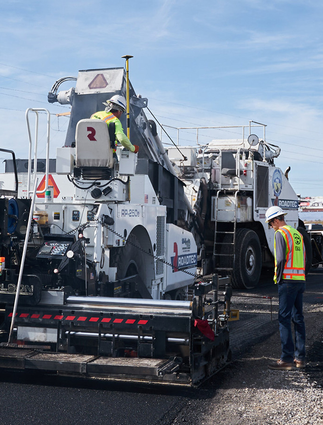
The Federal Highway Administration and State Departments of Transportation are increasingly adopting 3D modeling to leverage its benefits, particularly for GPS machine control. This technology enables paving equipment like rollers, pavers, and curb and gutter machines to accurately replicate a digital 3D model of the project.
As a result, more contractors are using 3D modeling to win bids and produce smoother, higher-quality paving, which improves work quality and boosts profits.
Accurate data capture is crucial for creating reliable 3D paving models. Traditionally, pavement surface data has been collected manually, but this time-consuming method does not always guarantee precision. By using an automated data collection system for 3D paving modeling, more accurate results are ensured. The industry increasingly relies on advanced laser technology to achieve the level of precision required for successful outcomes.
By adhering to a meticulous process, you can ensure your 3D paving model consistently delivers the most accurate results. Benchmark follows the procedure outlined below to ensure precision.
An initial project assessment provides essential information on how to move forward. With clear details about the processes involved in executing your project, you and your 3D modeling service provider can establish project goals and timelines to ensure successful completion.
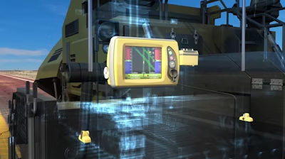
Accurate surface topography capture depends on the use of a laser projector and a camera. The laser generator projects laser beams onto the area to be paved, while a charge-coupled device (CCD) camera captures images of the beams, effectively gathering pavement depth data. This data is then stored in a database for further analysis.
Additionally, photogrammetry techniques can be employed to capture high-resolution images of the site. By taking aerial photographs, you can use photographic analysis to extract precise three-dimensional measurements.
Utilizing both laser and CCD technology, along with photogrammetry, ensures the most accurate data for your 3D paving modeling applications.
After data capturing, the next step is to convert data for 3D modeling. Data captured by a laser will be converted into three-dimensional data points with point-cloud modeling.
Partner with Benchmark, a global leader in data presentation, for unparalleled 3D paving modeling services and superior project outcomes. Our specialized team excels in precision and reliability in 3D machine control, ensuring your projects are completed faster and more cost-effectively.
Our responsive, around-the-clock service ensures fast turnaround times, while our skilled team of civil engineers, machine control experts, and professional surveyors bring a comprehensive blend of expertise to your projects. With over 20 years of experience in construction technology, Benchmark is committed to quality, customer success, and strong communication, supporting you every step of the way.
© 2024 All Rights Reserved
All right reserved Benchmark